THREATS

Analyzing for threats will highlight if there are any aspects and events that might potentially have dire consequences for your farm and people living there

By looking at these you’ll make sure that the site is safe from disasters and toxic influences from the neighborhood.

In this assessment you look at whether the property is located in any of these zones:

  1. Toxic
  2. Flood
  3. Wildfire
  4. Landslide

TOXIC ZONE


STEP 1. Locate the property on Google Earth

  • Launch the Google Earth application and zoom in on the property.

STEP 2: Look at the neighboring land

Check what the neighboring land used for.

1. Are there any conventional farming activities going on like growing conventional orchards or field crops?
2. Are there any recognizable toxic dump sites, drilling or mining operations (past or present)?

STEP 3: Look at the wider area uphill and upstream

  • Hold SHIFT key on your computer keyboard (Mac) or right click and hold (Win) and scroll around so you can see the terrain shape and slope. Identify the areas that are higher than the property.
  • Are there any conventional farms or the aforementioned toxic hazards above the land? If so, does the terrain channel the potential toxic runoff into the prospective property?

Type #1 Risk Assessment:

If there is any conventional farmland surrounding the property, the risk for contamination is very high. Anything toxic upstream or uphill presents a considerable concern and should also be avoided.

FLOOD ZONE


There are two types of flooding threats you need to analyze the prospective property for:

1) River flooding

2) Flash flooding

River flooding

– analyze if the prospective property is on a floodplain – 

The most common flood danger is along rivers, the flat plains surrounding the river begin to flood immediately when the river level rises.

STEP 1. Find a flood map of your area

STEP 2. Check if the property lies on a floodplain

  • Look at the map showing the flood zone hazard. Analyze if it lies on the floodplain.

Type #1 Risk Assessment:

Irrespective of the zone type, low probability of occurrence, levees or other water management structures the property should never be on any kind of floodplain.

Flash flooding

– analyze if the prospective property is in a narrow valley with a creek/stream –

Flash floods affect narrow canyons or valleys, where a large body of water descends from nearby mountains.

STEP 1. Locate the property on Google Maps

STEP 2. Turn on the globe view

  • Open the sidebar and click on the Globe View option. This will enable the 3D terrain view capability

STEP 3. Switch to 3D view

  • Press the 3D button under the compass symbol to tilt the view.

STEP 4. Check if the property is in a narrow valley

  • Press and hold the CTRL button on your keyboard and drag the mouse to get the full 3D view of the property location.

  • Look at the 3D terrain surrounding the property.

STEP 5. Check if there is a creek/stream in the valley

  • Switch from satellite to terrain view and look if there are any blue lines outlining the occurrences of creek or streams.

Type #1 Risk Assessment:

If the property is in the bottom of a narrow valley, then, whether or not you can see a creek running there, it’s a high-risk area. The chances are that a large summer thunderstorm can generate tons of water and funnel it down the valley. Look for properties that are on higher ground.

WILDFIRE ZONE


STEP 1. Determine if the property is located in a fire-dependent ecosystem

  • Fire-dependent ecosystems are any that occasionally need fire for the habitat vitality and renewal. These include biomes such as prairies, savannas, chaparrals, and coniferous forests. If the answer is yes, move to Step 2.

STEP 2. Locate the property on Google Maps

STEP 3. Check if the property is prone to life-threatening wildfires

Look at the satellite view of the property and check specifically for two things.

1. How densely wooded is the property and its surroundings?
2. How safe are the access points going out of the property in case of a fire?

Type #1 Risk Assessment:

If the property is a fire-dependent ecosystem then it’s crucial that there is at least a safe access way allowing prompt exit from the property in the case of life-threatening wildfire.

LANDSLIDE ZONE


STEP 1. Determine if the area has a history of landslide activity
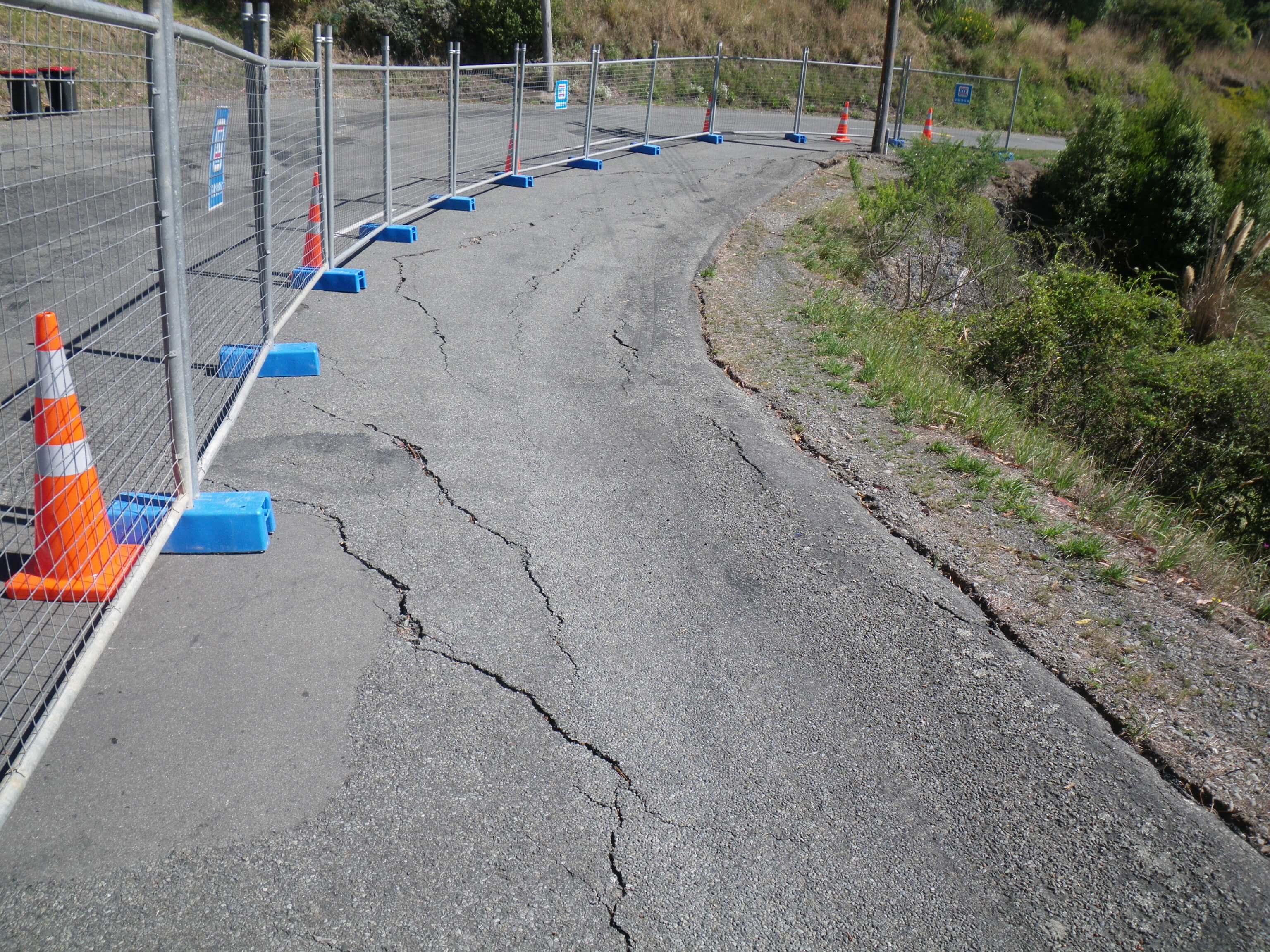
  • The best indicator that the area where the prospective property is located is at risk of landslides is previous landslides.

  • Perform the necessary Internet research and talk with the people in the area to find out if there were any landslide events in the past.

STEP 2. Look for tension cracks
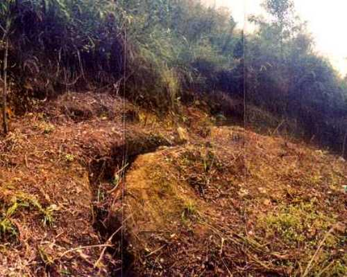
  • Tension cracks are created by the stress of geological material pulling apart. They often mark the eventual landslide scarp, the top edge of the failure zone.

  • You can identify them by looking at roads and seeing if there are any long cracks parallel to each other and to the slope.

  • Alternatively, you can do this by looking at the slope and seeing if there are any cracks in the ground.

STEP 3. Determine if there are obvious signs of things moving

  • When you’re in the area or on a prospective property check if there is any sign of subtle earth movement.

  • Looking at infrastructure: The best indicators of this are deformed fences, damaged structures, or subsidence.

  • Looking at a slope: On a moving slope, the most common indicator of slow movement will be trees bent up in a J-curve.

Type #1 Risk Assessment:

Landslides are a naturally occurring environmental hazard but they have recently increased in frequency in certain areas due to human activity. If you find any signs of landslide activity in the past or slow earth movement recently avoid the area altogether or focus your search on the safe distance away of the potential landslide threats.

Copyright © 2023 Permaculture Apprentice. All Rights Reserved | Privacy | Terms of Service |Member Agreement